Frequently Asked Questions
New to using the Argo app, or have some questions about how a feature works? Check out our frequently asked questions for help.
Be sure to also review our step-by-step Tutorials for detailed feature overviews.
Using the App
Yes, the app will likely be available for use in more countries worldwide starting in Fall 2026.
The app currently works anywhere in North America, including the U.S., Canada and the Caribbean. Depth data displayed is based on NOAA, USACE and Canadian surveys along with lake data for 12 states in the U.S. We are currently gathering depth data for additional states and have plans to begin crowdsourcing data.
Open this link. Then sign into your Argo account and choose your plan.
Sign into the Web app and go to the Premium subscription screen found listed under the menu options. If you have an active subscription through the web app you will see an option to cancel at the bottom of this screen.
Yes, Argo is FREE to download and FREE to use! Boaters who choose to upgrade to our Premium version get all our FREE features, plus extended weather, wind, tides and more.
Argo is compatible with both Apple iOS and Android phones, and works on iPad or Android tablet devices.
Yes, you can use the same account on as many devices as you like, even with our free version.
You do not need to register to download the app, however we recommend you sign in and set up your Argo Profile with your boat details to take full advantage of our app features and for safer navigation.
If you do not receive the confirmation email when signing up via Email Sign In, you can re-enter your account information, but an alternative is to reset your password or sign in using one of the other methods (Apple, Google or Facebook). You can also contact us or send us an email at support@argonav.io.
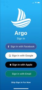
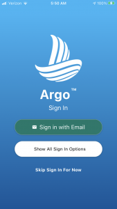
You can sign in to Argo using one of four methods: Apple, Facebook, Google, or Email. Each sign-in method will establish a separate Argo account associated with that email. If you log out of the app you will want to sign back in using the same sign-in method each time.
If you used email to sign in you can reset your password by going to the sign-in screen and tapping on ‘Forgot Password?’. You will receive an email message. Make sure to click the reset password link from your mobile device. See our How to Reset Your Password Tutorial.
If you used Apple or Google to sign in, a password is not required.
Argo will also show you the method you last used as the primary sign-in option (rather than listing all 3 methods) to make it easier to log back into the app.
Unless your device is set up to automatically update your apps, you will need to go to the App or Play Store and then update to the latest app version. You should not have to delete the app.
Tap on the Menu icon in the upper right corner of the main screen and scroll to the bottom.
Argo uses your location to show you where you are on the map and to assist with navigating. You need to set your location setting for ‘Always Allow’ or ‘All the Time’ so you will not lose your track and other key voyage info when the app is in the background or closed. This will ONLY be used when you are on a voyage.
Your Profile
Yes, you can create more than one Argo account using different sign-in methods with different, associated email addresses.
At this time you can only set up one boat per Argo account. You will need to create a separate account and profile for a second boat. We hope to add functionality for multiple boats on one account soon!
All Argo users can see your public profile, however only Argo friends will be able to see your Home Port. You can set your visibility and privacy on the map with our User Location Settings: selectable options are Public, Friends-Only, or Private.
Argo needs your boat information in order for the autorouting feature to run properly and safely for your boat. Argo uses the boat’s draft and buffer (margin of safety above your draft) to create safe color-coded routes for your boat. Argo also uses your boat’s average speed to calculate an accurate ETA (Estimated Time of Arrival) and estimated fuel/power usage to calculate estimated fuel or electric used for all routes you create. Your Home Port in your profile will make creating routes easier.
Yes, Argo will still create a route for you but it will be based off of a default draft of 5 feet and a buffer of 5 feet.
To edit your Boat Profile information, tap the Menu icon in the upper right corner of the main screen, and choose My Profile from the list of options. Tap on the Edit (pencil) icon next to the Boat Information section to add or change your boat info.
Yes, you can delete your account from the Delete Account screen in the app.
Creating Routes
There are four simple ways to create a route:
- Tap the Navigate button and select Route. Then simply tap the map or enter starting and destination points. If on the water it will assume your current location as the starting point.
- Tap the Navigate button and select Search. Then find and select a destination and tap Create Route.
- Tap on an icon on the map such as a boat ramp and when details of that place comes up, tap Create Route.
- Click and hold your finger on the chart in your intended destination. Select “Create Route” from the contextual menu that appears.
You currently cannot edit an autoroute. We intend to add the ability to add waypoints or interim points that could be used to customize routes in future updates.
You may be in Manual Route mode and need to switch to Autoroute mode. In the bottom left corner there is a toggle with options for Autoroute or Manual Route. Make sure the “A” is toggled on (colored blue) to use Autoroute. The app will save the last used mode.
The current routing may not always put you on the correct side of a navigational marker, but you should be in water that is deeper than your profile draft. If you are not comfortable with the depth the route is using then you should increase your buffer.
The routing algorithm is designed to provide you with the shortest path based on your draft and buffer using the current NOAA and USACE depth data. It does not take the markers or channels into consideration, not yet. That is something we are considering adding, perhaps a second optional route that’s longer but safer.
If you need to input gps coordinates in Degrees and Decimal Minutes (DDM) format (e.g., 38° 52.1900 N and 75° 09.094 W) or in Degrees Minutes Seconds (DMS) format (e.g., 38° 52’ 11.3988” N and 75° 9’ 5.6412” W), you need to convert them to Decimal Degrees (DD) format (e.g., 38.869833 -75.151567). Here is a good source for converting: https://www.pgc.umn.edu/apps/convert/
In the future we plan to update Argo to handle multiple formats.
The default longitude is West (minus sign). As you start typing a longitude into the entry field the minus sign will automatically appear. To change to East and remove the negative sign tap on West at the top of the keyboard, this will allow you to toggle the negative sign on/off.
Navigation & Map Views
You can inspect the chart symbols via the NOAA viewer at
https://www.nauticalcharts.noaa.gov/enconline/enconline.html
using the maritime identify widget. Tap on the Info icon and you will see a pointer. Click on the pointer and then tap on the map.
This document is what NOAA directs you to for their symbols. https://nauticalcharts.noaa.gov/publications/docs/us-chart-1/ChartNo1.pdf
Many of the features require an active internet connection (cellular or wifi, if available), but navigation and offline charts are now available by upgrading to our Premium version.
The app seamlessly goes into “offline mode”, but unless you have upgraded to the Premium version you will lose critical chart information used for navigating. With the Premium version you can download offline charts “before you go,” eliminating any connectivity concerns on the water.
To download offline charts you need to upgrade to the Premium version. Go to Menu in the upper right of the app and select “Unlock Premium Features”.
The charts and depths Argo uses are based on information obtained from NOAA, U.S. Army Corp of Engineers (USACE) and other government agencies. The depth is low median tide depth so should be lower than the actual depth. Also since NOAA data soundings do not cover all areas some approximations are made particularly closer to shore and around docks.
Tap the Map Options icon located on the main map and change to one of the four available map views: Standard, Satellite, Terrain and NOAA ENC.
Unfortunately we do not yet have depth data for all of the lakes. All features should work, even autorouting. We are in the process of collecting and integrating lake data. If there are lakes you would like us to focus on please let us know.
The Red Alert comes up on your screen if there are issues with the NOAA ENC server or internet connectivity. By tapping on the Red Alert you will be given the option to disable the NOAA ENC and move to a more reliable map view.
When moving, Argo should auto-recenter keeping you on the screen as long as you’re centered on the map. Hit the recenter button in lower right. Once centered it should auto-recenter for you… the map should move and you should stay in the center.
Tap the Speed Dial and change speed from knots to mph.
Tap the Depth Gauge and change depth from feet to meters.
Captain’s Log
From the list view, pull the voyage entry to the right and tap on the trash can, or from voyage details screen of a specific voyage tap the log button.
Check your device’s service connection to be sure you are connected to our server. Verify you are signed in and to the correct account in the event you have multiple Argo accounts.
Places & Pins
Drop a Place pin (e.g., private dock pin). Once you’ve added the pin to the map, tap on it to bring up the details, and then tap on the heart to save it as a favorite. You can also save it to your Captain’s Log by tapping the Log icon so it appears more prominently on your map. Once added to your Favorites list, you can save it as your Home Port within your Profile. Tap on the Menu icon from the main screen to get to your profile.
Create any one of our many Place pins by taping the![]() icon from Argo’s home screen. Add a name and description, make sure it selected as Private, then save it to the map. Once located on the map, tap on it and save it to the Captain’s Log by tapping the Log icon.
icon from Argo’s home screen. Add a name and description, make sure it selected as Private, then save it to the map. Once located on the map, tap on it and save it to the Captain’s Log by tapping the Log icon.
Favorites are just used for searching, but you can save your favorite places to the Captain’s Log to make them more prominent on the map.
If restaurants do not appear on the map you may have to zoom further in. An easier way to see what is in your area is to use Search, tap on a category, then tap on the map icon in the upper right corner. That will pull up a map view of the results. You can also move the map and then hit ‘Search this area’ to show the closest 20 places around where you have the map positioned. See Search to learn more.
We have added over 1000 searchable towns and cities. If we are missing a town or city that you would like added let us know.
You can find fuel docks near you by searching the fuel category. We are hoping that more marinas and yacht clubs will work with us to update their information including fuel.
For places such as marinas, yacht clubs, restaurants, etc. you can add a review, although it is even better to email us directly at support@argonav.io. For report pins you can add a comment.
Yes, if we don’t already have a location just drop a place pin to Add a New Place and submit to make it public.
New public place requests are reviewed before making it public. It might show up within the search within a couple of days but it will be a week or two before it gets on the map.
You can add a Fishing Spot pin and call it whatever you want. It will be a private pin that only you will see unless you choose to make it public.