")
If you’re someone who enjoys kayaking and you’re looking for an app to help you on the water, you’ve probably come across Argo and Strava. While both apps can be useful, they’re built for different things. In this post, I’ll break down how each one works for kayaking so you can figure out which one makes the most sense for you.
What Makes a Good Kayaking App?
Before comparing the apps, it helps to think about what most kayakers are looking for:
- A way to track their paddling trips (miles, time, etc.)
- Navigation help — especially in unfamiliar areas
- A place to plan routes or check for hazards
- Offline access, since cell service can be spotty
- The option to save and share trips
- Maybe even some community tips on good launch spots or interesting places to explore
Depending on whether you’re paddling for fitness, adventure, or both, your needs might vary a little. That’s where Argo and Strava differ.
Argo: Made for Boating and Kayaking
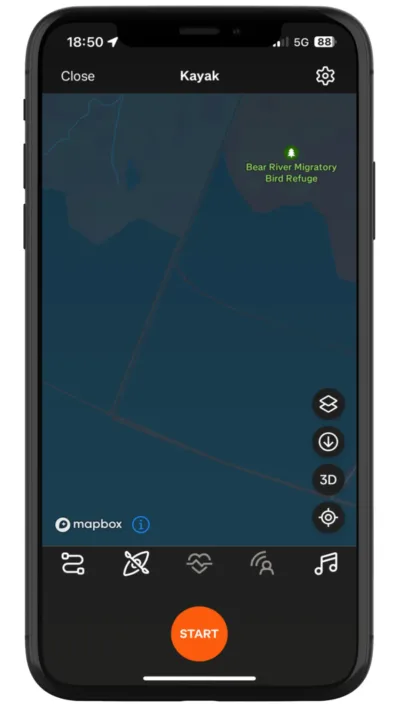
Argo is a navigation app built specifically for boaters and paddlers. It’s great for planning out trips, exploring new waterways, and staying safe on the water. While it does track your trips and show basic stats like distance and time, the main focus is navigation.
Here’s what stands out:
- Marine charts with helpful overlays like tides & currents, buoys, and water depths
- Offline charts, so you’re covered even without service
- The ability to plan customized routes with multiple stops
- A community layer, where people see each other on the water, join groups, plus share pins about marinas, launch ramps, rest stops, and more
- Trip tracking and trip replay, so you can look back at where you went
If you’re the kind of kayaker who’s exploring rivers, lakes, or coastal areas, Argo is super useful.
With Argo, you can add your kayak to your profile, including its draft (how deep it sits in the water). This helps the app tailor route suggestions and depth warnings based on your specific kayak.
Having depth info right on the map is especially useful in places with changing water levels or strong currents. For example, in deeper, fast-moving areas below dams or on certain rivers, I’ll check Argo ahead of time to see how deep it gets — and make sure I’ve got my life jacket on and know what I’m getting into.
As you can see, Argo is designed for kayaking. You don’t won’t have to piece together info from different apps or paper maps.
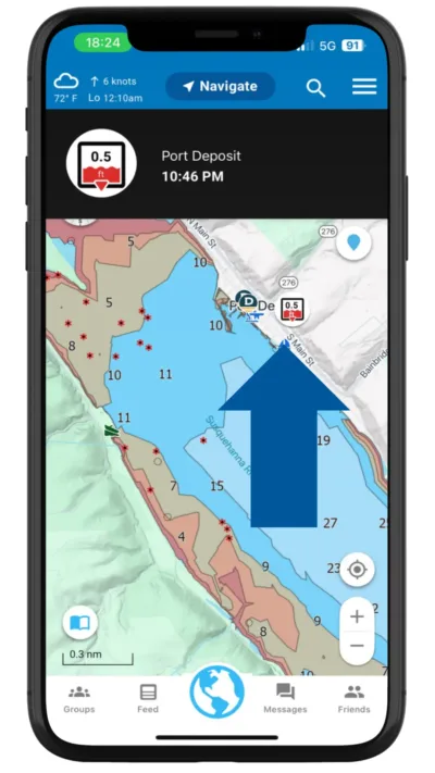
For example, you could check the Port Deposit tide station to know how much water is being released out of the Conowingo Dam before setting out on my kayak.
Strava: Built for Fitness Tracking
Strava is a fitness app used mostly by runners and cyclists, but you can use it for kayaking too. It’s great for tracking your performance — think distance, pace, calories burned, and heart rate if you’re using a compatible device. You can also set goals, join challenges, and see how you compare to others.
What it does well:
- Tracks speed, distance, and time in detail
- Shows your pace and splits for each segment of your paddle
- Connects with smartwatches, heart rate monitors, and fitness devices
- Has social features like giving “kudos” to other paddlers and joining clubs
If your main goal with kayaking is getting a workout or seeing your progress over time, Strava can be a great choice. Just keep in mind it doesn’t show you water-specific info like tide data, launch ramps, or navigation charts.
Strava shows limited chart information but it boasts a lot of fitness tracking capabilities.
Side-by-Side Comparison
| Feature | Column 2 | Strava |
|---|---|---|
| Navigation Charts | Yes – nautical/marine charts | No |
| Fitness Metrics | Not Detailed – time and distance only | Advanced – pace, heart rate, etc. |
| Offline Use | Yes (if charts are downloaded) | Yes (if maps are downloaded) |
| Route Planning | Yes – marine specific and customizable | No route planning |
| Launch Spots & POIs | Yes – crowdsourced community places | Not available |
| Community Building | Yes – create or join a groups | Yes – segments, challenges, clubs |
| Designed for Water Use | Yes – built for boating/paddling | No – not designed for waterways |
| Tide and Current Data | Yes – see information on the chart | No |
So, Which Kayaking App Should You Use?
It really depends on what kind of kayaker you are.
- If you’re looking to plan safe, enjoyable trips on the water, especially in new areas, Argo is a great fit. It gives you all the tools you need to be safe and stay aware of your surroundings.
- If you’re focused on fitness or training goals, and want to track your performance over time, Strava offers the kind of data and motivation that’s hard to beat.
- A lot of paddlers actually use both: Argo for navigation, trip planning and sharing, Strava for fitness tracking.
Final Thoughts
If you haven’t tried Argo yet, it’s free to download and easy to use. You can plan out your next paddle, avoid shallow spots or boat traffic, and even discover new launch areas. Whether you’re on a lake, river, or out by the coast, it’s a handy app to have with you.
You can create an account here.