Learn about all of the icons on your Argo map including place pins (marinas, yacht clubs, etc), report pins, buoys and beacons. You can tap each icon on your map to learn more about it.
Place Pins
Tap on a place pin to pull up a preview of the place details. The preview will show you the place’s name, distance away from you, and rating (if available). You can also create a route ![]() , add it to your favorites
, add it to your favorites ![]() , bookmark it to your Captain’s Log
, bookmark it to your Captain’s Log ![]() ,or share it to your Social Feed
,or share it to your Social Feed ![]() . Learn more here.
. Learn more here.

Anchorage

Artificial Reef

Beach

Boat Ramp

Bridge

Business

City/Town

Club/Association

Dam

Dock

Dock Bar

Fishing Spot

Hotel

Inlet

Light House

Lock

Marina

Mooring

Other

Point of Interest

Restaurant/Bar

Yacht Club
Report Pins
Tap on a report pin to see photos and a description (if available). From here you can also like, dislike and comment on the pin. Learn more about report pins here.

Hazards

Local Advice

Map Issue

Police

Weather

Marine Life
Navigational Aids

Buoys & Beacons

Lights

Rocks

Obstruction

Exposed Wrecks

Dangerous Wreck

Non Dangerous Wreck
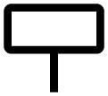
Mile Markers

Restricted Areas
Type of Buoys
Lateral Buoys
These aids show the sides of a navigable channels.


Junction Buoys
These aids mark the junction of navigable channels.


Special Buoys
These aids provide informational, regulatory, and warning signs.


Type of Beacons
Lateral Beacons
These aids show the sides of a navigable channels.
Junction Beacons
These aids mark the junction of navigable channels.
Special Beacons
These aids provide informational, regulatory, and warning signs.
NOAA ENC View
Trying to understand some of the symbols on the NOAA Electronic Navigational Charts (ENC) view? You can inspect the chart symbols via the NOAA viewer, using the maritime identify widget. Tap on the Info icon and you will see a pointer. Click on the pointer and then tap on the map.
Download the NOAA symbol reference document below.
