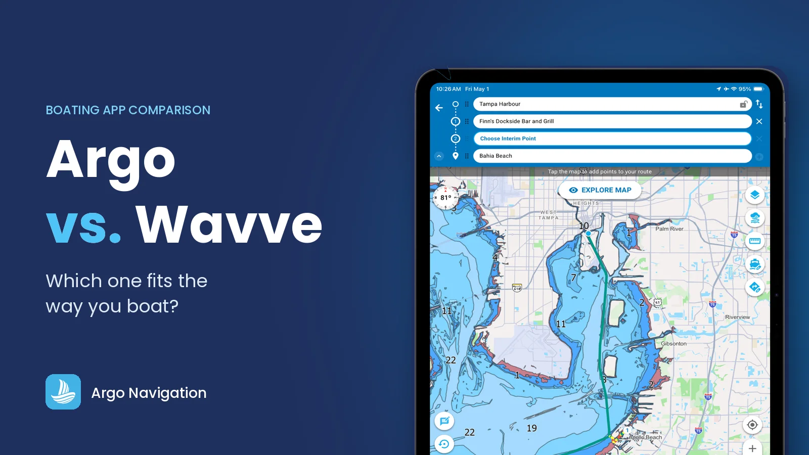
Whether you’re planning a weekend cruise, exploring new waters, or simply looking for an easier way to navigate, both Argo and Wavve offer modern alternatives to traditional chartplotters. While the two apps share some core navigation capabilities, they’re built around different philosophies.
Wavve focuses on a streamlined navigation experience with an emphasis on simplified chart presentation. Argo is designed to be just as approachable for a first-time boater while offering a broader set of capabilities that users can adopt over time. You can begin with simple route planning and navigation, then gradually take advantage of advanced weather tools, tides, destination discovery, electronics integration, and trip planning as your boating experience grows.
The result is that both apps can help you get on the water confidently—but they may appeal to different types of boaters.
Pricing
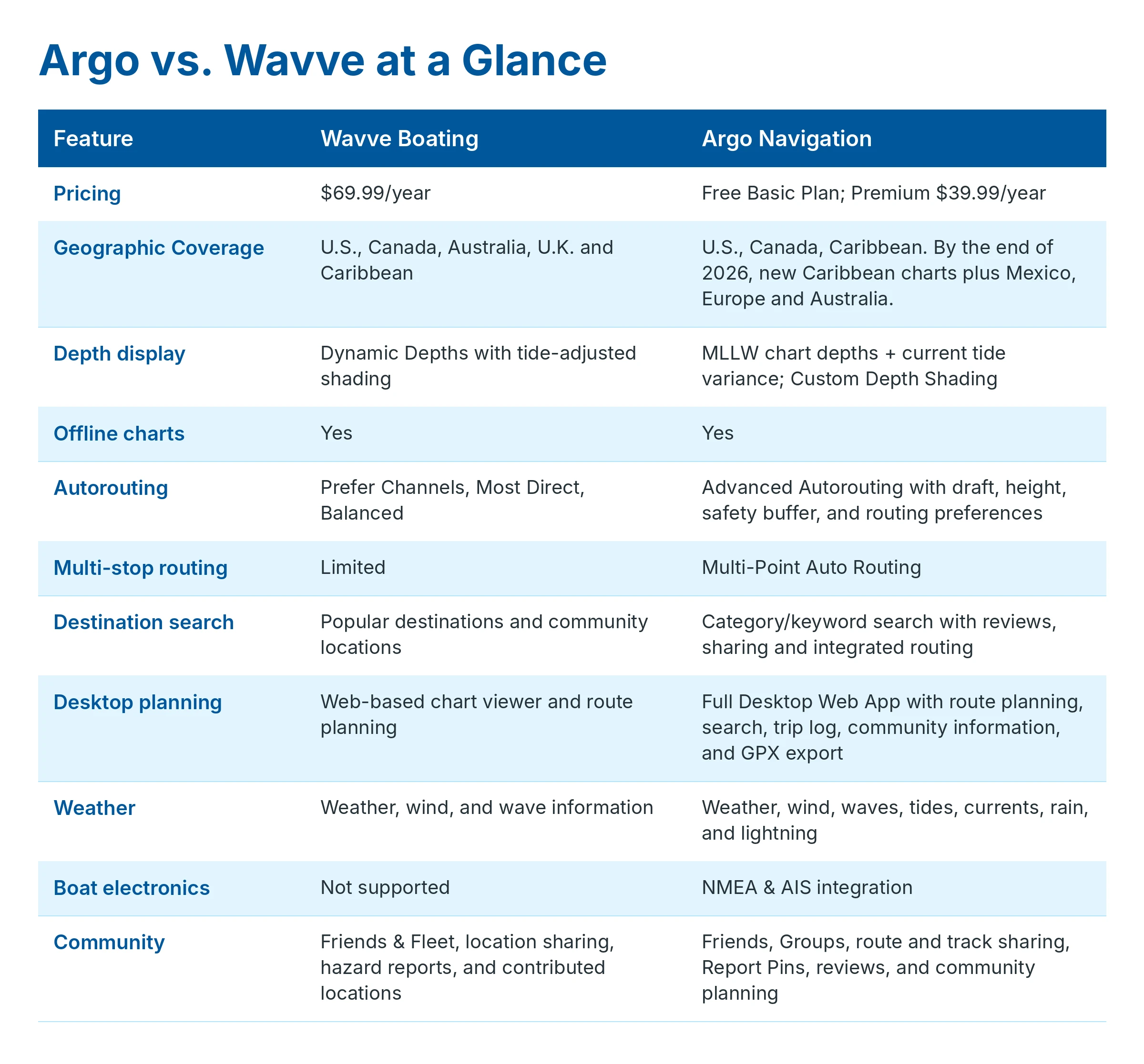
Wavve offers its navigation features through a paid subscription following its free trial. Its annual plan is $69.99 per year.
Argo offers a free Basic Plan that does not expire. It includes nautical charts, manual route planning, points of interest, Captain’s Log, personal waypoints, routes and tracks, and community features.
Argo Premium adds more advanced capabilities including advanced multi-point autorouting, offline charts, expanded weather tools, NMEA and AIS integration, and additional trip-planning features for $39.99 per year.
For boaters who want to start without committing to a subscription, Argo’s free plan provides a way to use the core navigation platform before deciding whether Premium features are necessary.
Ease of Use
Wavve Boating
Wavve prioritizes a streamlined interface that keeps navigation straightforward. Its focused design can make it easy for new boaters to understand the core tools they need for chart viewing, route planning, and basic trip preparation.
Argo Navigation
Argo shares that same goal of making marine navigation approachable. Its interface is designed so boaters can begin with essential navigation and planning tools, then gradually discover more advanced capabilities as their needs grow.
The difference is that Argo is designed to remain useful as boating becomes more frequent or more adventurous. Users can expand into destination discovery, weather planning, tides, desktop planning, electronics integration, trip logging, and community features without having to learn an entirely different platform.
Charts, Navigation & Offline Use
Reliable navigation begins with accurate charts, but it’s equally important that those charts remain available when cellular coverage disappears.
Wavve Boating
Wavve provides chart-based navigation and allows users to download charts for offline use, making it possible to navigate even when internet connectivity is unavailable.
Wavve’s signature Dynamic Depths feature automatically adjusts chart shading using predicted tide and water-level information, making changing conditions easier to visualize at a glance.
Argo Navigation
Argo also provides chart-based navigation and offline chart access. Boaters can download routes, charts, and key navigation data before leaving the dock, helping ensure critical information remains available when connectivity is limited.
Argo takes a different approach to depth information. Rather than modifying charted depths directly, Argo displays official chart depths based on Mean Lower Low Water (MLLW)—the same hydrographic reference used on NOAA charts—while separately displaying current tide variance and other environmental information.
Keeping these pieces of information separate allows boaters to compare surveyed chart depths with current water conditions before making navigation decisions. Because actual water levels can also be influenced by wind, atmospheric pressure, river flow, and localized weather, Argo’s approach emphasizes providing both the underlying chart information and current conditions instead of combining them into a single adjusted visualization.
Argo Premium also includes Custom Depth Shading, allowing boaters to personalize chart colors and contour lines based on the depths that matter most for their vessel and boating conditions.
Chart Coverage & Geographic Availability
A boating app is only as useful as the chart coverage available where you boat. Whether you cruise coastal waters, explore inland lakes and rivers, or travel to new destinations, geographic coverage is an important consideration when choosing a navigation app.
Wavve Boating
Wavve offers chart coverage across multiple regions, including the United States, Canada, Australia, the United Kingdom, and the Caribbean. Its coverage includes coastal waters, the Great Lakes, rivers, and many inland lakes. Coverage varies by location, so boaters can use Wavve’s online chart viewer to check the availability of chart data for their specific waterways.
Argo Navigation
Argo provides chart coverage across the United States, Canada, and the Caribbean. It combines official hydrographic chart data with U.S. Army Corps of Engineers survey data for additional detail in covered inland waterways.
Argo is continuing to expand its geographic reach. Before the end of 2026, the company plans to introduce new Caribbean charts and expand internationally to include Mexico, Europe, and Australia.
Chart availability and detail may vary by location, so boaters should confirm coverage for their intended cruising area.
Route Planning
Both apps offer automated routing, but they approach trip planning differently.
Wavve Boating
Wavve offers three autorouting styles: Prefer Channels, Most Direct, and Balanced. Routing takes the vessel’s draft into consideration, allowing users to choose the style that best fits the type of trip they are planning.
Routes include estimated trip duration and arrival time, and users can import and export routes when needed.
In our testing, however, route creation can be slow, particularly for longer or more complex trips, and Wavve occasionally cannot complete a route that should be navigable.
Argo Navigation
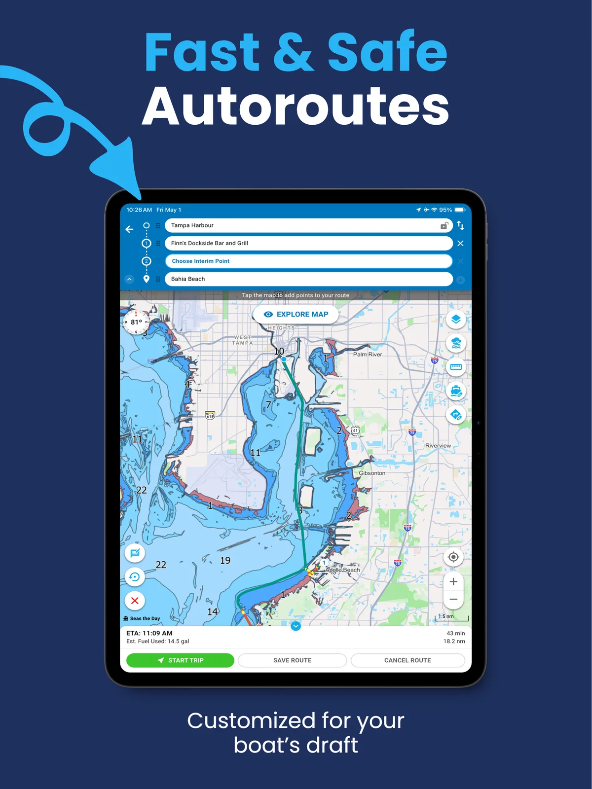
Argo’s Advanced Autorouting takes both vessel draft and height into account, along with a safety buffer selected by the user.
Boaters can choose routing preferences based on the type of water or trip they are planning, including Shortest Path, Inside Passage, Outside Route, and Stay in Channel.
For trips involving several destinations, Multi-Point Autorouting allows users to add and rearrange multiple stops within a single route. A weekend cruise with a fuel stop, anchorage, and marina can therefore be planned as one continuous trip rather than several separate routes.
Argo also estimates fuel usage alongside distance, duration, and ETA, providing additional information for planning longer trips.
In our testing, Argo created routes quickly and consistently, including longer and more complex routes, while still allowing boaters to customize or manually adjust the route when desired.
Argo provides faster and more reliable route creation, consideration of both draft and height, more routing preferences, multi-stop trip planning, and estimated fuel usage.
Finding Marinas, Fuel, Restaurants & Other Stops
Before you can build a route, you need somewhere to go.
Both apps help boaters discover destinations and points of interest, but Search is a more central part of the Argo planning experience. Instead of simply browsing map pins, Argo lets you search for the type of place you need, evaluate the results, and continue planning directly from the destination listing.
Wavve Boating
Wavve lets boaters discover popular destinations, mark points of interest, save favorite spots, and explore locations contributed by other users. This makes it useful for browsing the chart and identifying places to visit while planning a trip.
Argo Navigation
Argo lets you search by category or keyword and view results either on the map or in a list. Search results can include destinations such as:
- Marinas
- Fuel docks
- Anchorages
- Boat ramps
- Restaurants
- Beaches
- Yacht clubs
- Other boating points of interest
From a place listing, you can read reviews, save the destination, share it with others, or create a route directly to it. This connects destination discovery with the rest of the trip-planning workflow.
The difference is subtle but important. Wavve offers destination and community discovery within its navigation experience. Argo more closely connects Search with the complete planning process—from finding a place to researching it, saving it, sharing it, and routing there.
Weather, Tides & Conditions
Weather and water conditions can change quickly, so having environmental information available alongside navigation tools can make trip planning easier.
Wavve Boating
Wavve provides multi-day weather information with wind and wave data, allowing boaters to review upcoming conditions while planning a trip or while they are already underway.
Its Dynamic Depths feature also incorporates predicted tide and water-level information into chart shading, helping users visualize how available depth may change over time.
Argo Navigation
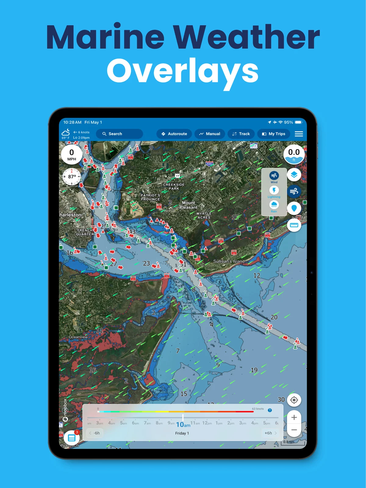
Argo’s 7-Day Weather, Wind, Tides & Waves tools provide environmental information directly on the chart.
Boaters can review wind, waves, tides, currents, rain, and lightning at locations along their route instead of only checking the conditions where their trip begins.
This allows someone planning a longer cruise to compare conditions at several points along the trip and make more informed decisions before leaving the dock or while underway.
Desktop Planning
Planning a day on the water often begins before you leave home.
Wavve Boating
Wavve offers a web-based chart viewer that allows boaters to explore charts, review potential destinations, and create routes that synchronize with the mobile app.
Argo Navigation
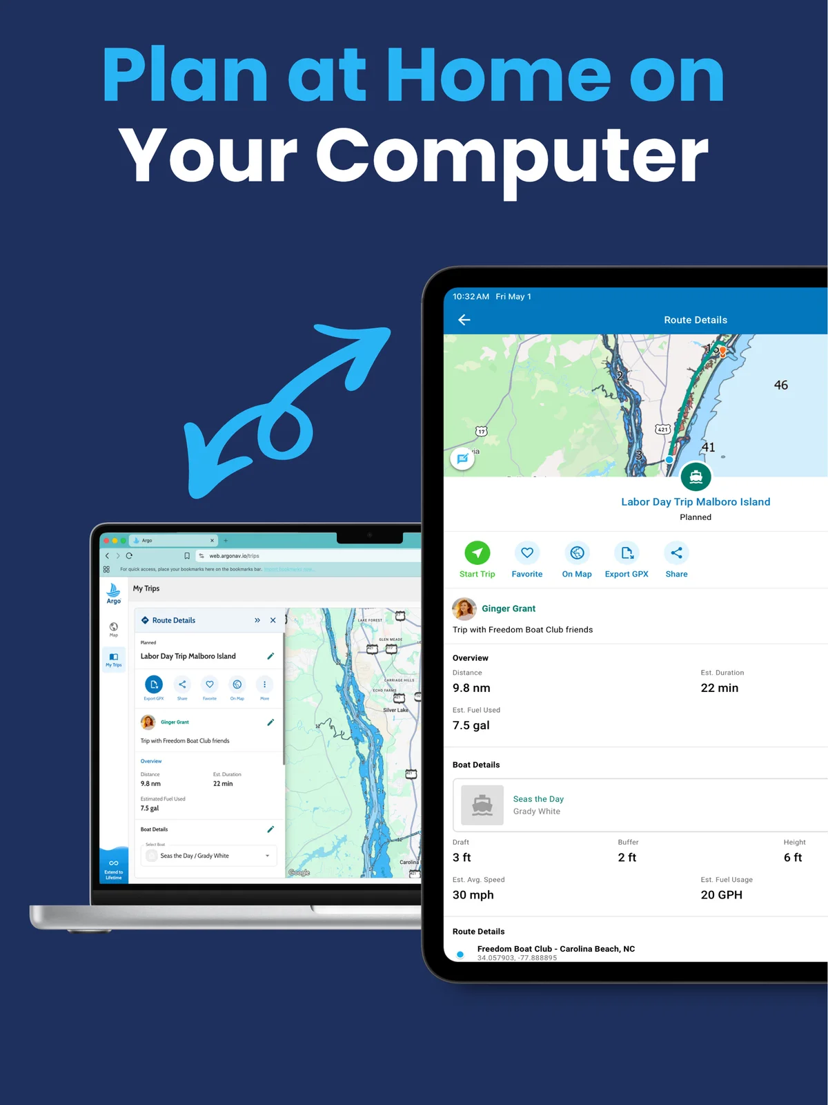
Argo’s Desktop Web App extends beyond route planning. Users can plan trips, search for and explore destinations, manage their Captain’s Log, review community reports and reviews, export GPX files, and seamlessly synchronize routes and activity with the mobile app.
For boaters planning longer cruises, researching unfamiliar waterways, or discovering new destinations, moving between desktop and mobile creates a more complete planning experience.
Friends, Groups & Community
Navigation is only one part of the boating experience. Many outings involve coordinating with family, friends, yacht clubs, or organized boating groups.
Wavve Boating
Wavve offers community-oriented features including friends, location sharing, hazard reports, and user-contributed destinations. These tools can help boaters see where friends are on the water and discover information shared by other users.
Argo Navigation
Argo places greater emphasis on helping boaters plan, discover, and coordinate together. Users can connect with friends, create public or private Groups, share routes and tracks, contribute destination reviews, add Report Pins, and coordinate group outings from within the platform.
Whether organizing a weekend cruise, sharing favorite anchorages, discovering a new destination, or helping club members plan an event, these collaborative tools extend Argo beyond navigation into a broader boating community.
Electronics Integration
For boaters with onboard marine electronics, the ability to connect navigation apps with information coming directly from the boat can become increasingly valuable.
Wavve Boating
Wavve is primarily designed as a mobile navigation platform and does not currently offer NMEA or AIS electronics integration.
Argo Navigation
Argo Premium supports NMEA and AIS connections, allowing compatible onboard electronics to send real-time information directly into Argo.
Depending on the equipment connected, boaters can view information such as depth and other instrument data from their vessel within the app.
With AIS connected, Argo can also display nearby vessels along with information such as speed, heading, and distance.
For boaters who begin with phone-based navigation and later add more electronics to their vessel, this integration allows Argo to remain part of the navigation setup as their equipment becomes more advanced.
Growing With Your Boating Experience
Perhaps the biggest difference between the two apps isn’t a single feature—it’s how each platform evolves with the user.
Wavve Boating
Wavve is intentionally streamlined, making it easy to get started with a focused navigation experience that also supports destination exploration and trip planning. For boaters who primarily want straightforward chart viewing, route planning, and a simple way to find places to visit, that focused approach may be a good fit.
Argo Navigation
Argo also aims to be approachable from the very first trip, but it layers in additional capabilities that boaters can adopt over time.
Many users begin with basic navigation and route planning, then gradually start using weather planning, tides, destination search, desktop planning, electronics integration, Captain’s Log, and community features as their boating habits evolve.
Rather than asking boaters to choose between simplicity and capability, Argo is designed to provide both. It meets new boaters where they are today while offering room to grow without requiring them to change platforms later.
Which App Should You Choose?
Choose Wavve if you:
- Want a streamlined navigation experience with destination exploration built in.
- Primarily need an easy-to-read chart and straightforward route planning.
- Like the convenience of Dynamic Depths and automatically adjusted depth visualization.
- Have boating needs centered around navigation, basic trip planning, and finding places to visit.
Choose Argo if you:
- Want an app that’s easy to learn but can grow with your boating experience.
- Enjoy planning trips before leaving the dock.
- Want to search for marinas, fuel, restaurants, anchorages, and other destinations and then quickly route there.
- Want to read reviews, save destinations, share places, and create routes directly from destination listings.
- Want integrated weather, wind, tides, destination discovery, electronics connectivity, and community features in one platform.
- Want faster, more reliable route planning for longer or more complex trips.
- Prefer a navigation platform that supports everything from casual day trips to extended cruising.
Final Thoughts
Both Argo and Wavve are capable boating apps that make navigation easier and more accessible than traditional chartplotters alone.
The primary difference isn’t simply the number of features—it’s the philosophy behind each platform. Wavve focuses on delivering a streamlined navigation experience that includes core trip planning and destination exploration.
Argo combines that same ease of getting started with a platform designed to help boaters navigate, discover new destinations, research places before they arrive, plan more confidently, and expand their boating experience over time.
For boaters who want an app that can grow alongside their experience—from their first day on the water to years of cruising—Argo offers a broader boating ecosystem without sacrificing simplicity.